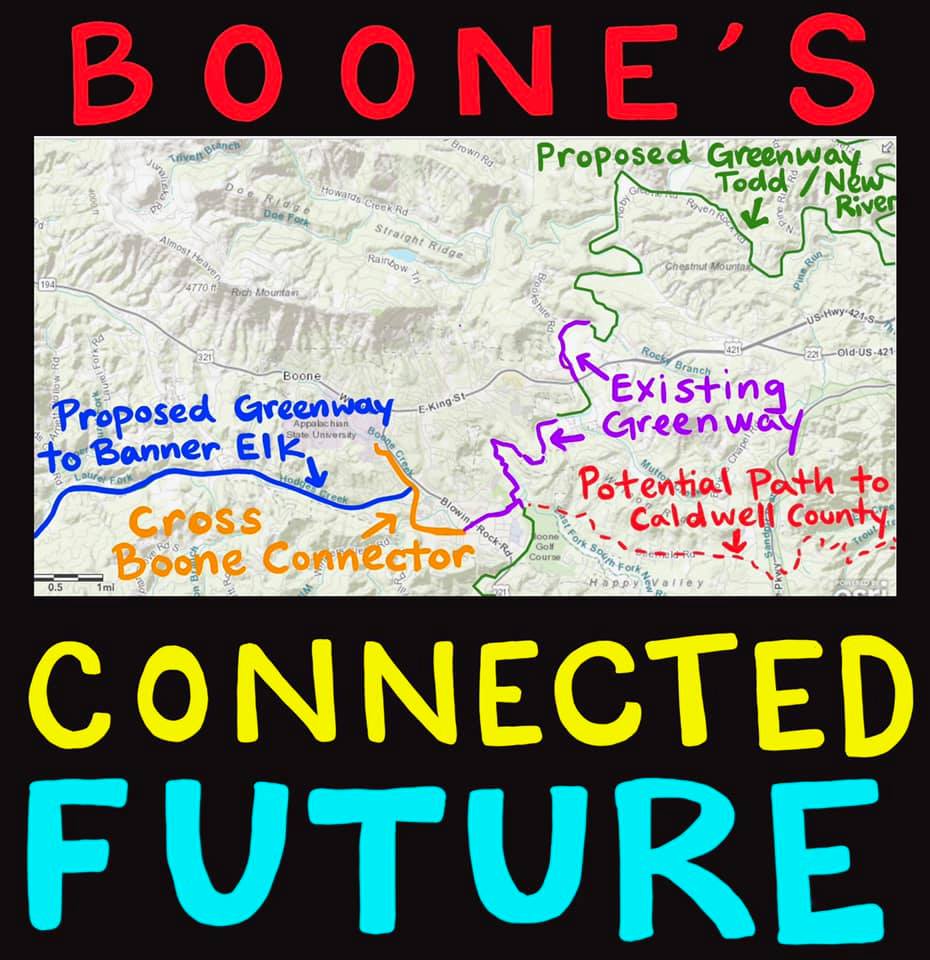
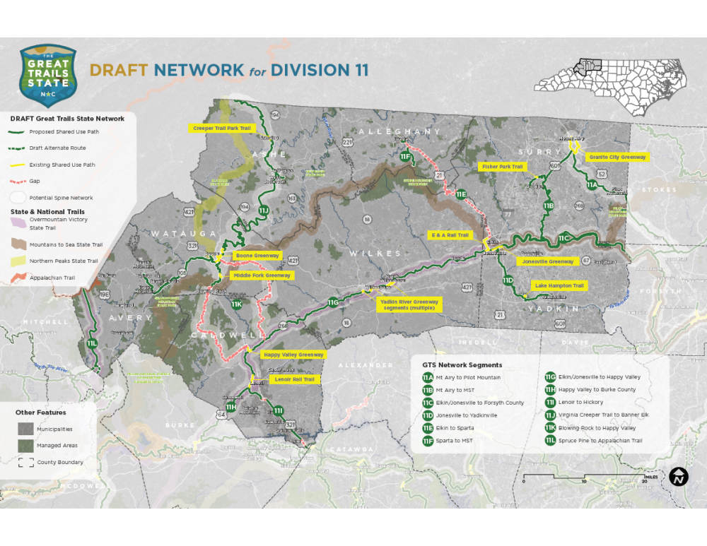
Go here to provide your feedback! The Boone area is in Division 11.
The Great Trails State Plan is a network of multi-use trails of statewide significance connecting North Carolina’s counties and population centers with state parks and important recreational assets. It is founded upon extensive local and regional efforts to plan and build trails.
The Great Trails State plan and network seeks to connect all counties and key destinations throughout the state to a growing network of strategic greenways. Other principal goals of the plan include:
- Foster connections between urban and rural areas in all 100 counties.
- Provide transportation options between where people live, work and play for people of all ages and abilities.
- Create opportunities for conservation, recreation, education, physical health, environmental health, tourism, and economic prosperity.
- Direct financial resources to plan, design, construct and connect the system.
- Facilitate multi-jurisdictional partnerships to support, develop, manage, and maintain the system.
Share your thoughts on the draft network.
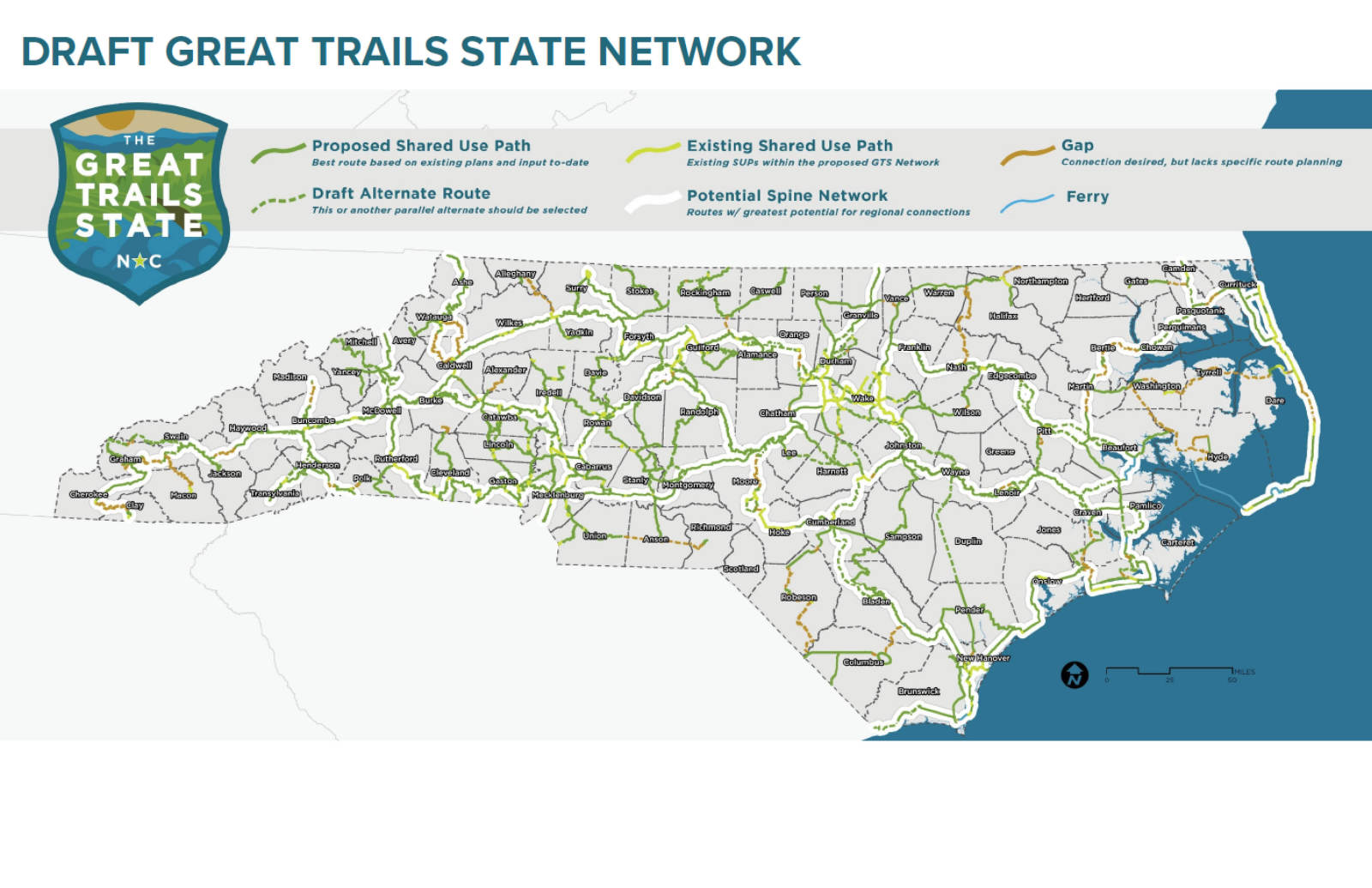
The draft Great Trails State network has been developed through a review of past and current planning efforts, steering committee input, a series of fourteen stakeholder workshops, and a public survey. The draft network is divided into 14 regional maps, representing each of NCDOT’s infrastructure planning regions, which are referred to as Divisions.
- Trail corridors in each Division map are divided into broad segments, as a starting point for the draft network.
- Segments are named by their connections between municipalities (e.g. Wilmington to Southport).
- Supporting trail information by segment is not yet defined on network maps (e.g. local trail names, supporting plans, key destinations, etc).
- Trail segments identified as Gap are on-road segments that require more detailed planning to determine off-road corridors.
Please provide comments on the Draft Great Trails State Network for North Carolina in the comment boxes below. The draft maps are available for download in PDF format in the Document Section below, and a web-based map of the draft network is available at the following link: https://arcg.is/1Gjyyy.
We encourage you to dive into the plan’s background material before reviewing the draft maps. Review the Great Trails State Plan Overview Presentation provided in the Document Section below, as well as the project webpage: https://www.ncdot.gov/divisions/bike-ped/great-trails-state/Pages/default.aspx
If you have questions, please email Kathryn Zeringue at kezeringue@ncdot.gov.